


Reducing Risk, Unlocking Opportunity. The Dealer’s Guide to Smarter GPS Tracking
A Buyer’s Guide for Independent Dealer, BHPH, and Auto Finance Leaders
- Reducing Risk. Unlocking Opportunity.
- How independent dealers and finance leaders use GPS tracking to balance smart lending with smarter control.
The Current Risk Reality
Independent dealers and finance companies have always balanced opportunity and risk. Approving the right buyers, managing tight portfolios, and recovering fast when payments fall behind are the foundations of profitability.
But today’s risk looks different.
Vehicle values shift rapidly. Borrower profiles have grown more complex. Recovery costs are higher, and every lost vehicle impacts working capital. The difference between success and strain comes down to one word: visibility.
Modern GPS tracking doesn’t eliminate risk — it transforms it. The ability to locate, monitor, and manage assets in real time gives operators more control, more confidence, and more room to grow.
Risk can’t be avoided. But with the right tools and partner, it can be managed — and turned into opportunity.
Visibility Is Profitability
Every operator knows that clarity drives profitability. Reliable GPS tracking delivers both — by turning unknowns into knowns and risk into data.
With dependable, real-time visibility, independent dealers and lenders can:
- Reduce recovery timelines and locate vehicles before losses escalate.
- Protect collateral and forecast loan exposure with accuracy.
- Streamline collections through verified location data that supports proactive outreach.
- Make better lending decisions with asset-level transparency that turns risk into strategy.
Visibility doesn’t just protect assets — it builds opportunity. When you know where your vehicles are and how they’re performing, you can safely offer competitive terms, extend credit to more customers, and grow revenue without increasing exposure.
Dealers using consistent, always-on tracking solutions report faster recoveries, stronger collections, and more predictable cash flow.
Reducing Risk and Unlocking New Opportunities
Independent dealers and finance companies don’t avoid risk — they manage it. The most successful operators know that risk itself isn’t the enemy; lack of visibility is.
Modern GPS tracking replaces uncertainty with actionable data. It helps convert credit risk into controlled opportunity — empowering teams to lend confidently, recover quickly, and optimize performance.
The right GPS program helps you:
- Increase recovery confidence. Real-time location data minimizes delays and simplifies repossessions, reducing the time and cost of recovery.
- Grant more approvals safely. Reliable GPS verification supports compliance and lending oversight by providing traceable asset data that protects both lender and borrower.
- Sell higher-value vehicles responsibly. Service reliability boosts your ability to sell high-value vehicles, allowing you to take calculated risks on premium inventory.
- Stabilize cash flow. Faster recoveries and improved collections reduce volatility and improve working capital consistency.
- Reduce administrative burden. Accurate reporting and easy monitoring save valuable staff hours.
- Enhance customer satisfaction. Reliable systems lead to smoother transactions and fewer disputes.
When GPS tracking becomes part of your operating strategy, not just a security add-on, it creates measurable financial upside. Reliable visibility, transparent pricing, and experienced support let independents grow confidently, lend smarter, and safeguard every deal.
“Visibility is the foundation of control — and control is the foundation of growth.”
Evolving Technology, Enduring Dependability
GPS technology has evolved — but the mission hasn’t.
Dependability still defines value.
Today’s systems blend advanced connectivity and low-power performance to deliver reliability that keeps pace with dealer operations.
Modern tracking solutions deliver:
- 4G/LTE connectivity with coast-to-coast reliability.
- Battery-powered flexibility for fast deployment and vehicle turnover.
- Deferred activation so billing starts only when the unit is installed and live.
Hardware alone doesn’t create reliability — partnership does. Independent dealers need responsiveness, not ticket systems. When vehicles move, time matters. Dependable technology backed by a partner who answers directly ensures problems are solved before they become losses.
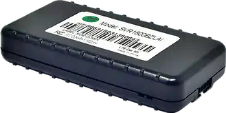
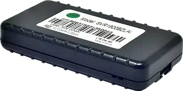
Wired vs. Battery — Choosing Based on Strategy
| Factor | Wired Trackers | Battery-Powered Trackers |
| Best For | Long-term loans, leases, Starter Disable | Short-term loans, rentals, high-turn inventory |
| Installation | Requires professional wiring | Quick self-installation in minutes |
| Flexibility | Fixed placement | Portable between vehicles |
| Customer Experience | Possible risk if installed incorrectly | No vehicle impact |
| Deployment Speed | 30 minutes per unit | 5 minutes or less |
Many high-performing independents use a mixed approach — wired for long-term assets and battery-powered for turnover. The best choice isn’t about the device type, but about the partner that ensures both work seamlessly, reliably, and at scale.
Five Qualities That Define a True GPS Partner
Visuals & Layout
Every provider promises reliability. Only a few prove it. These five qualities define a genuine GPS partner:
- Industry Understanding
The independent and BHPH model is unique. Choose a provider built for it, not one repurposing fleet solutions. - Proven Reliability
Look for multi-year warranties, field-tested devices, and recovery guarantees. Dependability is proven in the field, not in a brochure. - Personal Support
When recoveries can’t wait, customer service can’t be scripted. U.S.-based teams that answer directly and act immediately make the difference when timing matters most. - Transparent Pricing
No hidden renewals. No activation until installation. No minimum commitments. Predictability is protection. - Scalability and Consistency
Autoship and locked pricing programs show maturity — helping you scale with confidence and continuity.
Dealers trust partners who answer directly and act immediately, not chatbots or ticket queues.
Making an Informed Decision + The Experienced Difference
Making an Informed Decision
Before choosing a tracking provider, evaluate the factors that truly determine dependability:
- Is the technology field-tested for independent operations?
- Do they offer responsive, U.S.-based support?
- Are warranties aligned with your success, not their margins?
- Can you control activation and scale at your pace?
- Will they pick up the phone when recovery matters most?
Choosing a partner isn’t about the lowest quote — it’s about confidence that every device and every call will deliver value when you need it most.
The Experienced Difference
Experience isn’t measured in years — it’s measured in uptime, recoveries, and responsiveness.
Generic providers often enter the market with aggressive pricing but little industry context. Independent dealers need expertise that translates into trust.
“In a business built on risk, experience is your strongest form of insurance.”
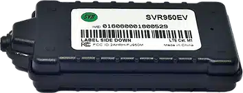
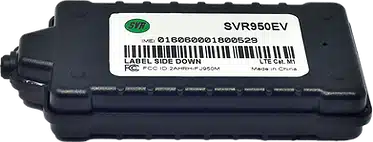
Partnering With the Proven Leader — SVR Tracking
For over 20 years, SVR Tracking has been the trusted GPS partner for independent dealers and finance companies nationwide, protecting more than one million vehicles.
SVR’s program reflects everything outlined in this guide — reliability, transparency, and partnership:
• No activation until installed
• Low-price guarantee with no monthly minimums
• 30-day risk-free trial
• 3-year warranty and recovery guarantee
• U.S.-based support
• Autoship programs and locked pricing for consistency
SVR Tracking was built for independents — dealers who depend on responsiveness, reliability, and relationships that last. Its technology empowers confident lending and its service ensures peace of mind.
Learn more at svrtracking.com/39reasons